A proposed overhaul would guide new housing, commercial investment and cultural destinations along the city’s three-mile corridor. The Planning Commission takes it up Oct. 22.
Highway 111 carries people past much of what defines Rancho Mirage: restaurants, automobile dealerships, shopping centers, civic buildings and mountain views. The city now wants the corridor to do more to bring those places together.
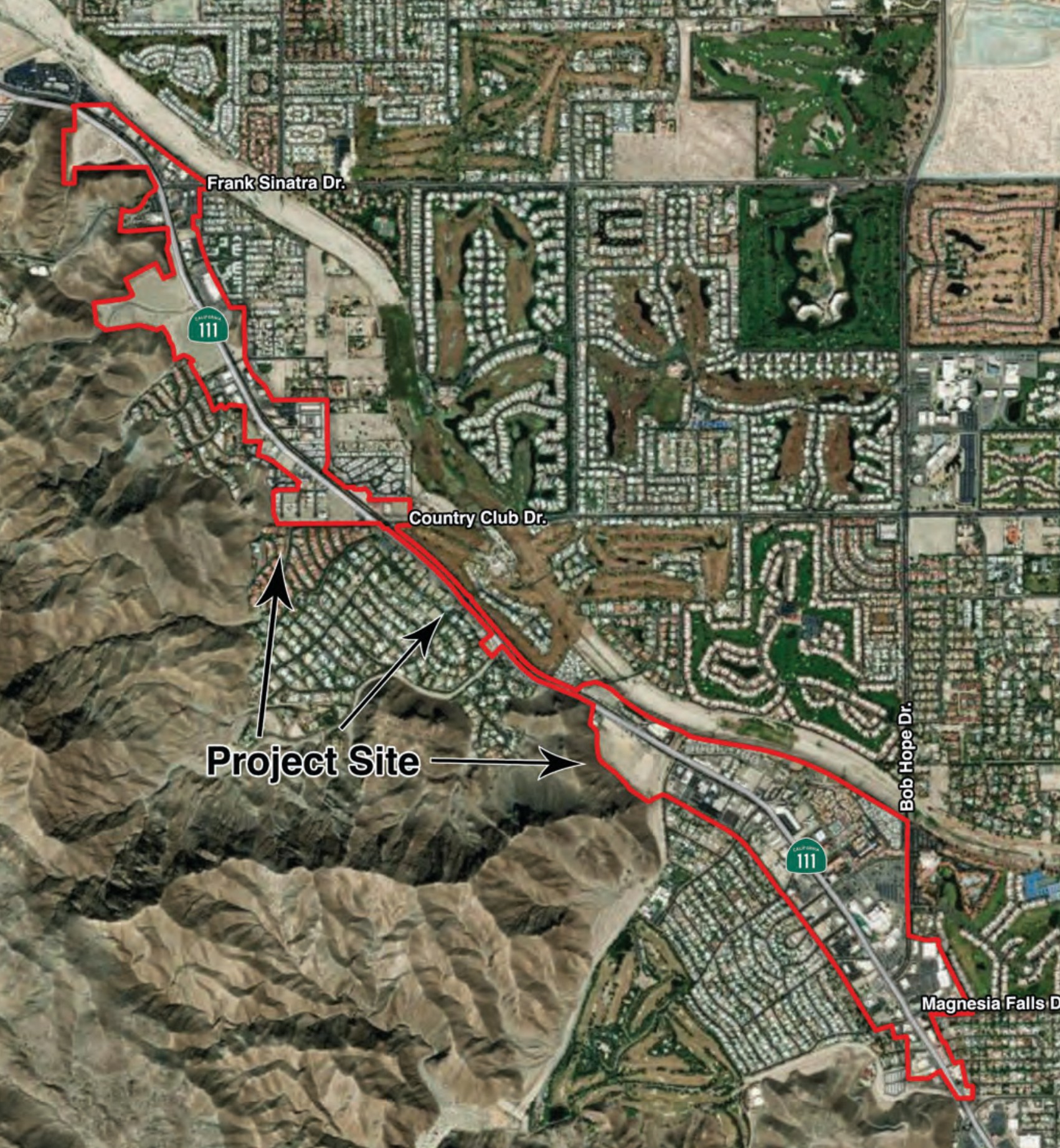
A sweeping land-use update headed to the Planning Commission on Oct. 22 would establish a single development framework for approximately 472 acres along the highway, opening opportunities for housing, mixed-use projects and reinvestment in older commercial properties while setting expectations for how those projects connect to their surroundings.
The proposed Highway 111 Specific Plan identifies potential for 862 additional homes and approximately 895,000 square feet of additional commercial development. Those figures describe estimated capacity under the plan, not approved construction projects or a forecast of what developers will build.
Its broader ambition is to help an established commercial strip become a more connected collection of destinations, where shopping, dining, housing and community life reinforce one another.
A New Highway 111 Specific Plan for a Changing Corridor
The update would replace separate plans adopted for the western and eastern portions of Highway 111 in 1989 and 1990. Both were revised in 2014, but their basic division remained.
The plan treats the roughly three-mile stretch from Cathedral City to Palm Desert as one corridor, divided into 12 planning areas with different development opportunities and neighborhood conditions. It covers approximately 552 parcels.
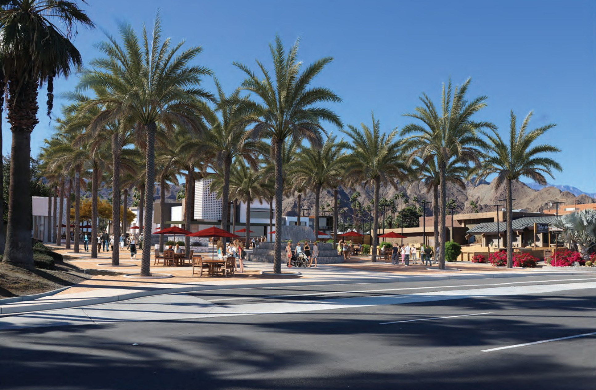
Highway 111 in Rancho Mirage, where a proposed specific plan would guide housing, commercial reinvestment and public-space improvements along the city’s three-mile corridor.
For property owners, the practical change would be a common set of rules for permitted uses, development standards, parking and design review. Where the specific plan establishes different standards from the underlying zoning, the plan would govern.
That consistency would not mean identical development everywhere. The proposal distinguishes between large vacant sites, established neighborhoods, shopping centers and cultural destinations. Some areas would accommodate substantial new development; others would receive more modest infill, building improvements or better pedestrian connections.
The approach reflects a priority city leaders outlined at Rancho Mirage’s 2025 State of the City, where Highway 111’s future figured prominently in the economic development discussion.
“Highway 111 shapes how they see our city,” Councilmember Eve Fromberg Edelstein said at that event, describing the impressions visitors form on their way to resorts, shops and restaurants.
Room for Housing and Commercial Investment
The plan’s updated land-use inventory estimates that the corridor contains 430 existing homes and approximately 1.82 million square feet of commercial development. Its additional development potential would bring those totals to about 1,292 homes and 2.72 million square feet of commercial space.
The estimates depend on assumptions about vacant land, allowed densities and commercial building intensity. Residential calculations account for site-specific conditions in several areas, while the mixed-use acreage calculation assumes an allocation of 80 percent to commercial uses and 20 percent to residential uses.
The numbers therefore establish the scale of the opportunity, rather than a construction schedule. Financing, demand, land assembly, infrastructure and individual project reviews would ultimately shape what gets built.
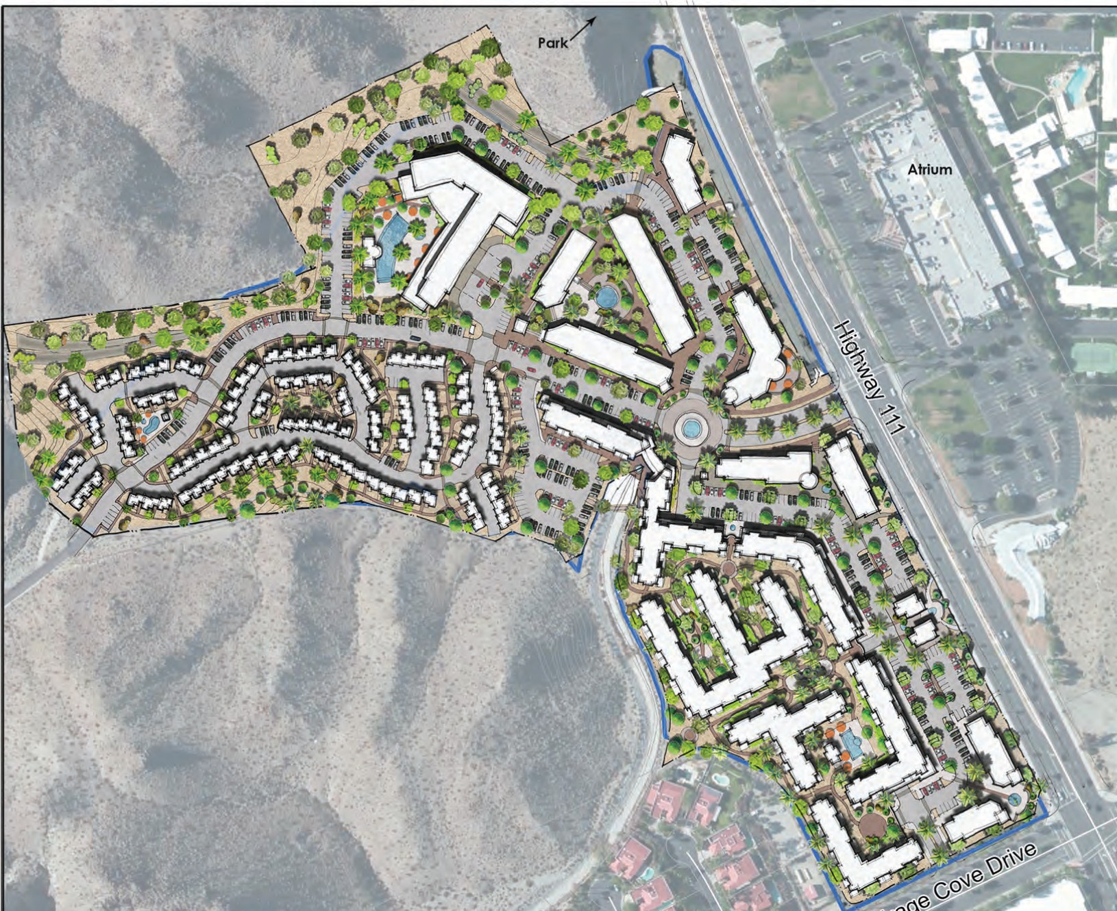
An illustrative development concept for Bighorn Cove shows how land southwest of Highway 111 near Mirage Cove Drive could accommodate a coordinated mixed-use development. The layout illustrates potential development rather than an approved project. Credit: City of Rancho Mirage/Terra Nova Planning & Research.
At the western entrance, the West Gateway planning area includes the vacant Rancho Cove opportunity site and existing commercial and office development, including One Mirage Place. The plan allows for coordinated development combining commercial, hospitality and residential components.
Bighorn Cove represents another major opportunity for a cohesive development with complementary uses, subject to the constraints of the cove and adjoining neighborhoods. Near the library, the Five Peaks area includes a significant opportunity site and an existing automobile dealership entitlement that the plan recognizes.
Elsewhere, the emphasis is on improving what is already there. The Peterson Road area is substantially developed, making the remaining infill sites, landscaping, access and connections between properties more important than wholesale redevelopment.
Private investment is already testing the corridor’s appeal. The Capital Grille is taking shape at the former Roy’s restaurant at 71959 Highway 111. A company spokesperson told GPS Business Insider in September that the restaurant is expected to open by spring 2027. That project predates adoption of the proposed plan, but illustrates the kind of reinvestment in an established property the city wants to encourage.
The River, Las Palmas and an Arts District
The plan would reinforce The River as a shopping, dining and entertainment destination, emphasizing reinvestment, pedestrian circulation and places for people to gather.
Across the corridor, Rancho Las Palmas Shopping Center would be brought into the unified planning framework as the Las Palmas planning area. The objectives there focus on tenant mix, visibility, shade, landscaping and parking while maintaining the center’s neighborhood-serving role.
The San Jacinto Arts District would build on a different combination of assets: housing, hospitality, commercial uses, the community park and amphitheater, and cultural activity. The plan supports galleries, shops, residential development and better pedestrian connections around San Jacinto Drive and nearby destinations.
Library Commons would strengthen the setting around the Rancho Mirage Library and Observatory, with attention to the paths, lighting and landscaping that support its role as a community gathering place.
At the Palm Desert boundary, the East Gateway would continue to emphasize home furnishings, design-related businesses, medical offices and other commercial uses. The intent is to give the entrance a more coordinated identity while supporting its existing business concentration.
These distinctions are central to the proposal. Its single permitted-use table identifies which businesses and activities are allowed, conditionally allowed or prohibited in each area. Adoption would not make every use available on every parcel.
Housing Near Services, With a Focus on Thunder Road
Housing is a substantive part of the corridor strategy. The plan supports residential and mixed-use development in designated areas, placing potential homes near businesses, services and transportation routes.
Thunder Road is a particular focus. The area already contains apartments and commercial uses, and the plan incorporates the affordable housing overlay adopted through the city’s certified housing element.
The city’s housing element calls for efforts to consolidate small vacant lots in the Thunder Road area into an economically feasible affordable housing project. The specific plan provides the land-use framework to support that objective.
The proposal also includes higher-density residential and mixed-use designations, with a stated range of 16 to 28 homes per acre for those categories. Actual development would depend on the applicable planning-area standards and project circumstances. The corridor’s estimated 862 additional homes should not be read as an affordable housing commitment; that figure encompasses potential residential development across the plan.
Parking, Shade and Connections Between Properties
Some of the proposal’s most consequential provisions concern the space between buildings.
The plan encourages shared parking among adjoining or complementary uses, allowing evaluation of parking across a coordinated site rather than treating every business as an isolated property. That could help owners make better use of land where neighboring uses have different parking demands.
Its transportation provisions address access drives, intersections, crosswalks, transit and neighborhood connections. Design guidance addresses shade, landscaping, screening and the relationship between buildings and the street.
For a desert commercial corridor, those details affect whether customers can comfortably move between destinations or must return to their cars for each stop.
The city would retain design expectations without imposing one architectural style. The guidelines recognize contemporary, midcentury modern, postmodern, International Style and Spanish Mission architecture, while emphasizing building proportions, materials, compatibility and scenic views. Lighting provisions seek to limit glare and protect the desert night sky.
Environmental Review Identifies Unavoidable Impacts
The update has been in preparation for years. Environmental review began in 2020, and the draft environmental impact report circulated for public comment in early 2022. The city also held a public informational workshop at the library in March 2022.
The current approval package includes mitigation requirements addressing construction emissions, biological resources, cultural resources, drainage, noise and other effects. Applicable measures would be imposed as individual development proposals move forward.
The proposed benefits include infill development, expanded housing and commercial opportunities, coordinated development standards, and additional sales and hotel-tax revenue. Those are the city’s stated reasons for approving the plan despite the remaining environmental effects, not a finding that the effects disappear.
Older documents describe a 684-acre planning area. Staff says the current figure of approximately 472 acres largely reflects corrected mapping and acreage calculations, including a change in the coordinate system used to measure land. It does not represent a comparable reduction in the corridor’s geographic reach. That recalculation is separate from the proposed boundary changes relative to the old plans, including the addition of Rancho Las Palmas Shopping Center and removal of approximately 16 acres of established residential development south of Mirage Cove Drive.
Oct. 22 Planning Commission Hearing
The Planning Commission meets at 2 p.m. Thursday, Oct. 22, in the City Council Chamber at 69-825 Highway 111. The Highway 111 proposal is Item 4.B on the meeting agenda.
Written comments may be sent to CityClerk@RanchoMirageCA.gov. The city requests submissions at least three hours before the meeting, making 11 a.m. the advance-submission time. Oral testimony is limited to three minutes per speaker, and the meeting will be livestreamed through the Planning Commission section of the city website.

Bob Marra is the CEO/Publisher of GPS Business Insider and GPS Market Intel. He has been studying, writing and giving presentations about business, economic and public affairs news and issues and the local economy in the Greater Palm Springs/Coachella Valley region for more than 20 years.